|
|
| Heavy flooding in Bangladesh and New Orleans has been in the news. | |
| Scroll down for links which will help you find out about it. You might want to do a search as well. | |
| Once you have had a look at the links, click on the NEXT fish at the foot of the page. | |
| The next page will ask you some questions about what you’ve found out. |
 |
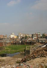 |
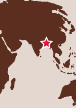
Bangladesh The risk of flooding is also increased as ice melts in the glaciers in the Himalayas which feed the rivers. In 2004, the capital city of Dhaka was seriously flooded: dozens of people died and over 100,000 people became ill from using dirty water. That year, about 700 people were killed in floods in the country as a whole, and millions had to leave their homes. |
| Bangladesh climate information: Discovery Bangladesh > |
||
| Banglapedia > | ||
| Virtualbangladesh > | ||
| 2005 Bangladesh flood warning > | ||
| Bangladesh flooding images > | ||
| News – Bangladesh working with China to protect against flooding > | ||
| Bangladesh country information > | ||
| For further activities on climate change in the Bay of Bengal, click here > | ||
 |
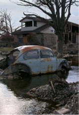 |
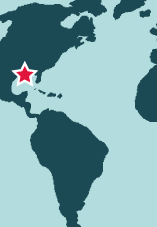
New Orleans, Louisiana USA In 2005, the city was seriously flooded following Hurricane Katrina. Almost all of its population had to leave, and over 1,000 people were killed. |
| New Orleans flood images > | ||
| New Orleans climate information > | ||
| New Orleans culture and history > | ||